Port Macquarie Surrounds
New South Wales · Port Macquarie, Mid North Coast
Live · ABS ERP June 2025
The median age is 50, higher than the middle New South Wales area (40, Census 2021).
Port Macquarie Surrounds has 5 schools (5 government, 0 non-government; ACARA School Profile 2025) and 3 NQS-rated childcare services (ACECQA register). Population is 5,331 (ABS ERP June 2025).
Port Macquarie Surrounds at a glance
Found this useful? Share it with a friend who is moving.

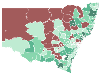
Boundaries: ABS Suburbs & Localities 2021. School pins are ACARA's published locations. Map © OpenStreetMap contributors, © CARTO. Open the full NSW map →
How the Family-Fit score is built47/100
Family-Fit score
Method published in fullLimited family services - strongest on everyday amenities, weakest on housing affordability.
- Schools in the area · 20% of the score
- 62/100
- Childcare & early years · 15% of the score
- 30/100
- Everyday amenities · 15% of the score
- 69/100
- Housing affordability · 15% of the score
- 28/100
- Families already here · 10% of the score
- 53/100
- Socio-economic profile · 10% of the score
- 33/100
NSW median 70/100
5 schools in this SA2 · average government-school ICSEA 912
NSW median 90/100
3 NQS-rated services nearby
NSW median 78/100
6 parks · no GP mapped (not counted) · 1 supermarket · 3 playgrounds
NSW median 38/100
Paying over 30% of income on housing: 20.1% of mortgage-holding households, 40.9% of renting households
NSW median 67/100
16.8% of residents are children aged 0–14 · 38.0% of families are couples with children
NSW median 56/100
SEIFA IRSAD decile 4 of 10 nationally
The grey marker on each bar is the median across the 612 New South Wales areas we publish a score for (state median overall: 64/100). It is context, not a pass mark.
Not scored here (no published data for this area, so it is left out rather than counted as zero): Getting around. The remaining inputs were rescaled to 100.
How this score is calculated
Each published figure for the Port Macquarie Surrounds SA2 is mapped onto 0–100 by fixed thresholds, then weighted. Inputs with no data here are dropped and the rest rescaled - never scored as zero. Every threshold and weight →
School results, crime and flood or bushfire overlays are not graded into this score. Limits of the score →
What families notice
What families notice
- 6 parks mapped inside this SA2 (OpenStreetMap).
- 5 schools sit inside this SA2 - more choice than most areas this size.
- The zoned government school for part of this area sits just outside this SA2 - check the exact catchment boundary before assuming.
- We don't yet have official crime data for NSW (only NSW and VIC) - that's a data gap on our side, not a claim this area is safe.
- About 41% of renters here spend over 30% of income on rent - above the standard affordability guideline (ABS Census 2021).
Living in Port Macquarie Surrounds: family snapshot
Living in Port Macquarie Surrounds
A smaller suburb. 3 NQS-rated childcare services nearby. Mostly detached family homes.
Port Macquarie Surrounds compared with New South Wales10 measures
| Measure | Port Macquarie Surrounds | NSW average | Against NSW |
|---|---|---|---|
| Children aged 0 to 4 | 4.2% | 5.8% | Lower |
| Children aged 5 to 14 | 12.5% | 12.4% | About the same |
| Couple families with children | 38.0% | 44.5% | Lower |
| One-parent families | 12.3% | 15.9% | Lower |
| Homes owned outright | 49.7% | 31.9% | Higher |
| Homes owned with a mortgage | 33.2% | 33.7% | About the same |
| Homes rented | 13.6% | 32.5% | Lower |
| Separate houses | 96.4% | 67.4% | Higher |
| Flats and apartments | 0.0% | 20.3% | Lower |
| Born overseas | 8.6% | 29.3% | Lower |
Source: ABS Census 2021. The NSW figure is the population-weighted average of the 641 NSW areas with a published value. "Higher" and "Lower" describe the number only.
About this area and its boundary
Port Macquarie Surrounds is a locality in the Port Macquarie area of New South Wales. This profile draws on ABS population and Census figures, the ACARA school register and ACECQA childcare ratings for the Port Macquarie Surrounds SA2.
5,331 residents - 16.8% are children under 15, median age 50.
This profile uses the ABS Port Macquarie Surrounds statistical area (SA2) - the level Australian government data is published at. SA2 boundaries don’t always match suburb boundaries. It covers the gazetted suburbs of Telegraph Point, Comboyne, North Shore, Byabarra, Mortons Creek, Riverside, Cooperabung and Frazers Creek and 40 more localities, drawn separately on the map above.
Property market
No free house sale price or 3-bedroom house rent is published for this area. 13.6% of homes are rented, against 32.5% across New South Wales.
Homes and households
Source: ABS Census 2021. Where the shares do not add to 100%, the rest is "other" or "not stated".
Housing cost pressuremortgage and rent against income
Housing cost pressure
In Port Macquarie Surrounds, 40.9% of renting households spend more than 30% of their income on rent, and 20.1% of households with a mortgage spend more than 30% on repayments - the ABS's stretched-household threshold (Census 2021).
ABS published figures, not our calculation.
- Mortgage over 30% of income
- 20.1%
- Rent over 30% of income
- 40.9%
NSW avg 17.3%
Share of households WITH a mortgage whose repayments take more than 30% of income. That's 123 of 528 households with a stated repayment.
NSW avg 35.5%
Share of RENTING households whose rent takes more than 30% of income. That's 103 of 222 households with a stated rent.
The two figures cover different households (mortgage-holding vs renting), so never add them. How the ABS counts these → Grey marker: NSW average (622 for mortgage and 622 for rent). Census 2021 - housing costs have moved since. Not financial advice.
What's being built herenew homes approved, year by year
What's being built here
24 new homes were approved in Port Macquarie Surrounds in the year to June 2025. Councils approved 93 new dwellings here across the 6 years to June 2025 - an approval is permission to build, not a home that exists yet.
Approved in the year to June 2025
Middle NSW area: 37
Separate houses
Private sector, over these 6 years
Townhouses & apartments
Private sector, over these 6 years
Counts are for the whole Port Macquarie Surrounds statistical area. What these counts include → Dashed line: the median of 599New South Wales areas.
Schools and childcare
5 schools are located in the area, and the centre of the area is zoned to Beechwood Public School. 3 childcare services are on the national register, 3 rated Meeting the National Quality Standard or above.
Beechwood Public School
The government school your child can attend for free by living in Port Macquarie Surrounds.
The government catchment school for parts of Port Macquarie Surrounds is Beechwood Public School - just outside the suburb boundary (NSW catchment data).
See the catchment on the mapThe government Year 7 zone for the centre of Port Macquarie Surrounds (NSW catchment data) - addresses elsewhere in the suburb may be zoned to a different school.
We show school intake context and catchments, not exam results. We don’t publish a school ranking.
All school zones in the Port Macquarie-Hastings council area →
To look beyond Port Macquarie Surrounds, every New South Wales school is on the Australian schools and catchment zones map.
Find the school zone for an address in Port Macquarie Surrounds
Type a street address in Victoria, NSW or Queensland. We show the government primary and secondary school zones it is in, from the official zone maps.
Your address goes from your browser straight to OpenStreetMap's address search to find it on the map. We never see it or store it. Address search © OpenStreetMap contributors.
Schools in Port Macquarie Surrounds
- Students
- 126
- ICSEA
- 968
- Students
- 36
- ICSEA
- 926
- Students
- 36
- ICSEA
- 887
- Students
- 24
- ICSEA
- 939
- Students
- 22
- ICSEA
- 838
ICSEA reflects student intake context, not teaching quality (1000 = national average). Source: ACARA School Profile 2025. All NSW schools →
Childcare: 3 services
National Quality Standard ratings from the ACECQA register, refreshed Oct 2026. Services are matched by suburb name.
Childcare services, ratings and fees3 services
- Exceeding NQSLong Flat PreschoolCentre-Based Care · 20 places · Long FlatRated Mar 2026
- Meeting NQSActive OOSH Telegraph PointCentre-Based Care · 30 places · Telegraph PointRated Sep 2022 · over 3 years old, check for a more recent assessment
- Meeting NQSComboyne Community Preschool KindergartenCentre-Based Care · 20 places · ComboyneRated Jun 2021 · over 3 years old, check for a more recent assessment
- Centre-based day care
- $14.13/hr
- Outside school hours care
- $9.27/hr
Mean hourly fee across CCS-approved services, December quarter 2025 - Dept of Education, © Commonwealth of Australia, CC BY 4.0. Published at SA3 level (a wider area than this suburb's SA2), so it's an average across Port Macquarie and surrounds, not this specific service list.
Verify locations before visiting. A rating over 3 years old is flagged. What the NQS ratings mean → Childcare places per child, by suburb →
Who lives here
Fewer people born overseas than New South Wales overall: 8.6% of residents, against 29.3% statewide.
Ages of people here
Share of residents in each age band, in years. Source: ABS Census 2021.
How the area is changingCensus 2011 to 2021
Each line is drawn on its own scale, so compare the numbers, not the heights. Source: ABS Census 2011, 2016 and 2021; Travel Zone Projections 2024 (TZP24), Transport for NSW forecast, published for the council area, not the suburb.
Census trends against the middle NSW areafull charts
Which way this area is moving
The 2011, 2016 and 2021 Censuses for Port Macquarie Surrounds, counted on today's boundaries.
Since 2011, Port Macquarie Surrounds has grown older.
- People counted
- +261 people since 2011
- Median age
- +4 years since 2011
- Children aged 0–14
- −0.5 pts since 2011
- Born overseas
- −0.9 pts since 2011
- Speak another language at home
- −0.3 pts since 2011
Usual residents counted on Census night.
Half the residents are older than this, half younger.
Share of all residents. The clearest signal of families arriving or moving on.
Share of all residents born outside Australia.
Share of residents who stated a language, speaking one other than English at home.
The dashed line is the median across the New South Wales areas we profile. How the three Censuses line up →
How many people will live around hereofficial forecast
How many people will live around here
The rest of this page looks backwards. This is the one number that looks forward - and it is the state government's own, not ours. Travel Zone Projections 2024 (Transport for NSW) projects the Port Macquarie-Hastings council area, which contains Port Macquarie Surrounds along with its neighbouring suburbs, to grow to 96,630 people by 2041: 9,980 more people than the 86,650 counted in 2021.
This is the council area, not Port Macquarie Surrounds. Port Macquarie-Hastings is a whole local government area covering many suburbs, and neither state publishes a projection for a single suburb. Growth is never spread evenly across a council - a greenfield estate and an established street inside the same council will move very differently - so read this as the direction of the wider area a suburb sits in, not as a forecast for its own streets. Only the years the publisher itself lists are plotted: nothing is filled in between them, and nothing is carried past 2041. A projection is an assumption about the future, not a measurement of it, and it will be revised - this one was released 2024. These figures sit on the projection's own series, so they are not directly comparable with the ABS resident-population and Census counts elsewhere on this page, which use different geographies and different years.
Where this year's population change came from+0.50% in a year
Where did the gain come from?
+28Reading the streams: Australian movers from other suburbs drove most of the change.
Ages against the state average, band by band
Ages of people here
12.5% of people here are school-age children (5–14) - about the New South Wales average of 12.4%, and 4.2% are under 5. The median age is 50.
- 0–4 years · before school
- 4.2%
- 5–14 years · school age
- 12.5%
- 15–19 years · teens
- 5%
- 20–34 years
- 11.9%
- 35–54 years
- 23.7%
- 55–64 years
- 18.5%
- 65 years and over
- 24.3%
NSW avg 5.8%
NSW avg 12.4%
NSW avg 5.7%
NSW avg 20.3%
NSW avg 26.3%
NSW avg 11.9%
NSW avg 17.6%
Share of all residents of Port Macquarie Surrounds (ABS Statistical Area 2) at the 2021 Census; the grey marker is the New South Wales average. How the bands and averages work →
Households and families
Households and families
50% of families here have children living at home - fewer than the New South Wales average of 60%. The largest overseas-born communities are United Kingdom (2.8%), New Zealand (1.3%) and Germany (0.3%). 14% of homes are rented.
Family make-up
Share of all families in the area. A small "other family" group the ABS also counts is not shown.
- Couple with children
- 38%
- One-parent family
- 12.3%
- Couple, no children
- 48.8%
NSW avg 44.5%
NSW avg 15.9%
NSW avg 37.9%
What people live in
Share of occupied private dwellings. Other and unstated structures are not shown.
- Separate house
- 96.4%
- Semi-detached / townhouse
- 0.9%
- Flat or apartment
- 0%
NSW avg 67.4%
NSW avg 11.6%
NSW avg 20.3%
Owned or rented
Share of occupied private dwellings. Other and unstated tenures are not shown.
- Owned outright
- 49.7%
- Owned with a mortgage
- 33.2%
- Rented
- 13.6%
NSW avg 31.9%
NSW avg 33.7%
NSW avg 32.5%
Figures describe Port Macquarie Surrounds (ABS Statistical Area 2) at the 2021 Census; the grey marker is the New South Wales average. How these are counted →
Birthplaces, languages and communities
Who lives in Port Macquarie Surrounds
Top 5 overseas birthplaces shown · 95% born in Australia or a country not in the top five.
- United Kingdom · established by 2016
- 2.8%
- New Zealand · established by 2016
- 1.3%
- Germany · established by 2016
- 0.3%
- Ireland · growing since 2016
- 0.3%
- Netherlands · growing since 2016
- 0.3%
NSW avg 3.2%
NSW avg 1.1%
NSW avg 0.1%
NSW avg 0.1%
NSW avg 0%
- Nearby
- Wauchope, Port Macquarie - West and Laurieton - Bonny Hills also have an established United Kingdom community.
- Settlement pattern
- Of overseas-born residents who stated when they arrived, 4.7% arrived in the last 5 years (2016–2021) (NSW avg 16.2%) and 79.3% arrived before 2001 (NSW avg 52%).
- English at home
- Of residents who speak a language other than English at home and stated their English proficiency, 4.1% report speaking English “not well” or “not at all” (NSW avg 13.5%) - a self-reported ABS figure across all languages combined, not a judgement of any one community.
Figures describe Port Macquarie Surrounds (ABS Statistical Area 2) at the 2021 Census. The ABS publishes only the five largest communities per area, so a missing name did not rank in the top five. How these are counted →
Socio-economic index (SEIFA)decile 4 of 10
- Decile (1 lowest, 10 highest)
- Decile 4 of 10
- Where this sits in NSW
- bottom 40% of New South Wales areas
A relative comparison of the whole area against all of Australia - not a safety, liveability, or school-quality measure. What IRSAD measures → Source: ABS SEIFA 2021, IRSAD index (SA2).
Getting around and lifestyle
1 supermarket and 6 parks are mapped in the area, and the nearest emergency department is Wauchope District Memorial Hospital, 26 km away in a straight line.
Mapped inside the Port Macquarie Surrounds boundary. A zero can mean "not mapped" rather than "not there". Source: © OpenStreetMap contributors.
Train to the city and nearest emergency department
Train to the city
Not publishedNew South Wales publishes its timetable data behind a free developer account we have not yet set up, so we show no travel time here. This is a gap on our side, not a statement about the transport in this area.
Nearest emergency department
MappedWauchope District Memorial Hospital · 26 km
Straight-line distance from the middle of this area - not a drive time. In an emergency call 000; do not plan around this figure.
Community and recreation
Out with a baby
Public-toilet facilities recorded on the National Public Toilet Map - not every place in the area that will let you change a baby.
About this data
Counts of features tagged in OpenStreetMap inside the Port Macquarie Surrounds boundary. “Middle NSW area”: the median of 634 New South Wales areas. How these counts and times are made →
Source: © OpenStreetMap contributors · baby-facility counts from the National Public Toilet Map (Continence Foundation of Australia, funded by the Australian Government Department of Health, Disability and Ageing, CC BY 3.0 AU)
Crime & safety in Port Macquarie Surrounds
We don't have an official incident count matched to this specific area yet - that's a data gap on our side, not a claim that Port Macquarie Surrounds is safe. SuburbRadar does not rate suburbs as safe or unsafe. More on crime & safety →
Risks
4 of the 4 planning and hazard records we hold show something in this area: bushfire, heritage controls, traffic noise and acid sulfate soils. 3 more are not published for NSW - treat them as not checked.
Bushfire
Designated Bush Fire Prone LandPresent in this area
Heritage controls
In an official overlayPresent in this area
Traffic noise
Freeway or highway presentPacific Motorway · U Turn Bay
Acid sulfate soils
Classified in the local planPresent in this area
Each line is the extent of an official record across the whole Port Macquarie Surrounds area - not a risk rating, and a specific address may or may not be affected. Not financial or insurance advice.
All 9 checks and what each one means
Flooding
Not publishedNew South Wales publishes flood planning maps council by council, with no free statewide layer we can republish - check the local council's flood planning map for this area.
Bushfire
Designated Bush Fire Prone LandPresent in this area
Part of this area is mapped as Bush Fire Prone Land by the NSW Rural Fire Service. This designation is drawn broadly around vegetation across most of NSW, so read it as "check the property", not as a measure of how exposed the area is.
Heritage controls
In an official overlayPresent in this area
Part of this area sits inside the heritage layer in the local environmental plan, so changes to buildings there - extensions, demolition, sometimes even paint colours - need planning approval. It applies property by property: most homes in an area with an overlay are not in it, and being in one is a protection as much as a restriction. Almost every NSW area contains some heritage-listed land, so read this as "check the address", not as something that sets this area apart.
Traffic noise
Freeway or highway presentPacific Motorway · U Turn Bay
2 named roads through this area carry OpenStreetMap's highest classification - a freeway, motorway or major highway, whatever the road is called locally, alongside 6 named main roads. Roads are counted by name, not by mapped segment. Where a home sits relative to them matters far more than the count - a street two blocks back can be quiet.
Aircraft noise
Not mappedNew South Wales maps aircraft-noise contours only where a council or precinct plan writes them in - four councils and the Western Sydney Airport precinct do. Sydney Airport's contours are published federally in its master plan and are not in the state layer, so read this as "nothing mapped here", not as a quiet area.
Land contamination checks
Not mappedNew South Wales records contaminated land in the EPA's searchable register of notified sites rather than in a planning-scheme map layer, so we have no overlay to show for this area. Search the NSW EPA contaminated land record for a specific address - nothing mapped here means we have not checked it, not that the land is clear.
Acid sulfate soils
Classified in the local planPresent in this area
Part of this area is classified for acid sulfate soils in the local environmental plan, which means work disturbing the soil below a set depth needs council consent. Acid sulfate soils are harmless while they stay wet and buried; digging into them - for a pool, footings, a basement or drainage - exposes them to air and produces acid that eats concrete and steel and can kill fish downstream, so excavation may need a management plan. The class describes how close the soils are likely to sit to the surface, not how bad they are. Much of the low-lying land around the coast and its rivers is classified, so read this as "check before you dig", not as something that sets this area apart.
Recorded crime
Not publishedNo suburb-level incident record matched this area in the published statistics.
Social housing
Census figure0.0% rented from a state or territory housing authority · 0.0% from a community housing provider
Share of occupied private dwellings here with a stated tenure (Census 2021). The middle NSW area is 1.6% public and 0.7% community, across 624 areas. Listed because families ask; it is a fact about who owns the homes, not a judgement about the people in them.
About this data
Every line is an official published record for the Port Macquarie Surrounds area - we don't rate, score or rank any of them. Where a line is missing, treat it as not checked rather than clear. What each line covers and does not →
Source: NSW Rural Fire Service Bush Fire Prone Land, © State Government of NSW and NSW Rural Fire Service · NSW Planning EPI Heritage, Airport Noise + Acid Sulfate Soils, © State of New South Wales, Department of Planning, Housing and Infrastructure - CC BY 4.0 · ABS Census 2021 (G37 tenure and landlord type) · © OpenStreetMap contributors (ODbL) - road classification
Nearby suburbs
- Wauchope 11 km
- Port Macquarie (West area) 26 km
- Laurieton (Bonny Hills area) 27 km
- Port Macquarie (South area) 28 km
- Port Macquarie (East area) 29 km
- Kempsey 44 km
The six closest profiled areas in New South Wales, by distance between area centres.
The suburbs in this area
Everything else on this page is published for Port Macquarie Surrounds as a whole - one ABS statistical area covering 48 separate gazetted suburbs. These are the figures published for each of the 42 the ABS publishes a profile for.
| Suburb | Residents Census 2021 | Schools | Median house price |
|---|---|---|---|
| Telegraph Point | 604 | 1 | $690k |
| Comboyne | 416 | 1 | $660k |
| North Shore | 371 | 0 | $950k |
| Byabarra | 329 | 0 | $790k |
| Mortons Creek | 309 | 0 | $790k |
| Riverside | 298 | 0 | $950k |
| Cooperabung | 293 | 0 | $690k |
| Frazers Creek | 215 | 0 | $790k |
| Blackmans Point | 178 | 0 | $950k |
| Ellenborough | 171 | 0 | $790k |
| Rollands Plains | 151 | 0 | $690k |
| Upper Rollands Plains | 150 | 1 | $690k |
| Lower Pappinbarra | 136 | 0 | $790k |
| Brombin | 127 | 0 | $790k |
| Gum Scrub | 121 | 0 | $690k |
| Pembrooke | 118 | 0 | $790k |
| Bellangry | 114 | 0 | $790k |
| Long Flat | 112 | 1 | $790k |
| Pipeclay | 102 | 0 | $790k |
| Ballengarra | 97 | 0 | $690k |
| Kindee | 91 | 0 | $790k |
| Huntingdon | 86 | 1 | $790k |
| Pappinbarra | 86 | 0 | $790k |
| Marlo Merrican | 60 | 0 | $790k |
| Hollisdale | 52 | 0 | $790k |
| Upper Pappinbarra | 48 | 0 | $790k |
| Yarras | 48 | 0 | none published |
| Bago | 45 | 0 | $790k |
| The Hatch | 44 | 0 | $950k |
| Bagnoo | 43 | 0 | $790k |
| Hyndmans Creek | 41 | 0 | $790k |
| Hartys Plains | 36 | 0 | $790k |
| Birdwood | 34 | 0 | $790k |
| Toms Creek | 33 | 0 | $790k |
| Limeburners Creek | 32 | 0 | none published |
| Mount Seaview | 28 | 0 | $790k |
| Innes View | 26 | 0 | $660k |
| Boorganna | 24 | 0 | $660k |
| Forbes River | 20 | 0 | $790k |
| Hacks Ferry | 9 | 0 | $690k |
| Debenham | 5 | 0 | $790k |
| Gearys Flat | 3 | 0 | $790k |
6 smaller localities are also inside this area. The ABS publishes no separate census profile for them, so they have no row here.
Each row is that suburb's own published figure - nothing here is the wider area's number divided up. Resident counts are the Census 2021 usual-resident count for the gazetted suburb, so they will not add up to the population at the top of this page, which is the ABS's later June 2025 estimate for the whole statistical area: a different measure on a different date. Schools are ACARA-registered schools whose published address falls inside the suburb boundary, which is not the same as the school your address is zoned to. Median house prices in New South Wales are published by postcode, not by suburb (marked *), so suburbs sharing a postcode show the same figure - it describes the postcode, not the individual suburb. Every other figure on this page - crime & safety, overlays, commute, amenities, projections, the Family-Fit score - is published for the whole statistical area and cannot be separated by suburb.
Other areas in Port Macquariesorted by growth in one year
More in New South Wales
Braidwood
NSWBraidwood is a locality in the Queanbeyan area of New South Wales. This profile draws on ABS population and Census figures, the ACARA school register and ACECQA childcare ratings for the Braidwood SA2.
Karabar
NSWKarabar is a locality in the Queanbeyan area of New South Wales. This profile draws on ABS population and Census figures, the ACARA school register and ACECQA childcare ratings for the Karabar SA2.
Queanbeyan
NSWQueanbeyan is a locality in the Queanbeyan area of New South Wales. This profile draws on ABS population and Census figures, the ACARA school register and ACECQA childcare ratings for the Queanbeyan SA2.
Where this is in NSW